by Stephen Sorenson
Northland Community & Technical College’s Geospatial Intelligence Analysis Program: Riding the Wave of the UAS Tsunami
How does Northland Community & Technical College’s (NCTC) Geospatial Intelligence Analysis Program tie into general aviation and Unmanned Aircraft Systems (UAS) technology?
Changes in UAS regulations and requests for Section 333 Exemptions have been, and continue to be, growing exponentially. In April of 2015, the number of requests was around 99; in June 2015, it was around 524; and to date, there are more than 3500. Reports of UAS (drone) sales to farmers around the United States for Christmas 2015 were estimated at 45,000 (Grand Forks Herald, January 21, 2016). With the rising use of UAS and the ever-increasing requests for Section 333 exemptions, the volume of imagery and data collected by these aircraft will amount to a virtual tidal wave of information. How can all that newly acquired imagery and information be processed? Who will be able to do it?
 If you want to ride the wave of the UAS Tsunami, you don’t want to be standing on the beach when it crests. Where you want to be is out ahead of the crest, waiting for the swell. How do I get to the swell? Grab your board and follow me…to NCTC.
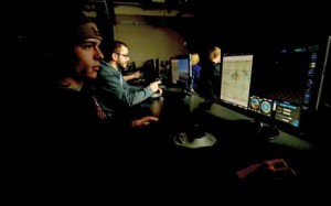
What is the Geospatial Intelligence Analysis Program at NCTC? The Geospatial Intelligence Analysis Program at NCTC contains the Imagery Analysis Certificate and the Geospatial Intelligence Analysis AAS Degree. It is designed to prepare students to, in basic terms, identify an issue, take a picture, gather information, combine the picture and information on a Geographic Information System (GIS) like Google Earth, and use that to assess the issue and find a resolution.
The Imagery Analysis Certificate concentrates on distinguishing imagery from a variety of sources, cameras, radar, satellites, and identify what information the image is showing. Students learn to identify key features and precise measurements and interpret how the imagery relates to maps and charts. Students acquire a variety of skills ranging from UAS general knowledge to a precise depiction of the imagery objective. Students receive hands-on training with many forms of imagery to include still satellite imagery, full motion video and UAS-derived imagery.
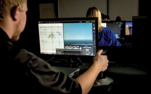 The Geospatial Intelligence Analysis AAS Degree takes a student through the end-to-end process of planning, preparing, and conducting Geospatial Intelligence Operations from the customer’s request, to determining how to collect the information, such as identifying weed growth, to analyzing and producing a geospatial product like geo-referenced polygon layers that answer the customer’s needs. These products can then be turned into actionable products, in this example precision agriculture prescriptions for automated fertilizer or herbicide application.
What we are doing at NCTC? Paddling into position. Working in coordination with the UAS programs under a grant from the Minnesota Department of Agriculture, we were able to use the University of Minnesota Magnusson Research Farm near Roseau, Minn., to fly imagery missions with a Sentera Phoenix fixed-wing UAS over some of the test plots to gain imagery and data for use in crop analysis and precision agriculture. Some of the current projects we are working on are weed mapping, aphid (insect) infestation, and drainage issues. Combining imagery with historical data and pattern analysis can help to provide predictive analysis of growth patterns, persistence issues, and potential yield changes.
In gathering and processing the images for use in precision agriculture, we gained some valuable insights and a couple of lessons learned. One of the lessons we learned early on was the large number of variables that can affect the quality of the images. Some variables are out of our control, such as wind, crop movement and clouds. Other variables, such as altitude, aircraft speed, and sensor angles can to some extent be controlled or mitigated. One of the big benefits of utilizing Small Unmanned Aircraft Systems (sUAS) for capturing the imagery is the ability to more finely adjust movement of the aircraft and sensors to help address these issues.
What is Geospatial Information? Geospatial Information is defined as “information that identifies the geographic location and characteristics of natural or constructed features and boundaries on the earth and includes: (A) statistical data and information derived from, among other things, remote sensing, mapping, and surveying technologies; and (B) mapping, charting, geodetic data, and related products.” (10 U.S.C. 467 (4)). We take the geospatial information and further enhance or develop it in ArcGIS. ArcGIS is a very dynamic Geographic Information System (GIS) that allows for a wide spectrum of geographic and geospatial analysis and exploitation in order to be able to produce Geospatial Intelligence.
What is Geospatial Intelligence and how is it different from Geospatial Information? Geospatial Intelligence is defined as “the exploitation and analysis of imagery and geospatial information to describe, assess, and visually depict physical features and geographically referenced activities on the earth. Geospatial Intelligence consists of imagery, imagery intelligence, and geospatial information.” (10 U.S.C. 467 (5)) Once you’ve gathered the imagery, information, and data, you can begin to combine, organize and analyze it into a fused geospatial product.
Part of our work with the Minnesota Department of Agriculture is doing drainage assessments. Gathering and coordinating data from the local watershed district to identify current ditch networks, and combining that information with data and imagery from the Minnesota DNR greatly assists us in analyzing water flow patterns and potential secondary and third order effects of drainage and tiling adjustments.
The swell before the storm. With the ability to gather all this information, imagery, and data, together with the corresponding analysis, the potential uses for these geospatial products and applications throughout business and industry is limited only by one’s imagination. From county plat maps, watershed districts, livestock tracking, law enforcement and emergency management, search and rescue operations, DNR tracking of forestry and wildlife, to construction site selection, bridge inspections, and marketing demographics. The possibilities are endless.
You’ve got the training; the swell of demand is growing; time to ride the Tidal Wave of Information.
As with anything involving large amounts of information and/or data, organization is paramount. How you organize and store your information for easy use and retrieval can often determine success or failure. There are many good systems out there that can help you achieve this goal. However, the best systems are those that are interoperable, meaning they can interface with the other systems in your toolkit. Whichever systems you use, this should be the key feature.
As the imagery and current/historical data is recorded, analyzed and used to produce GIS products in answer to consumer needs, it will raise additional requests or demands on technology. These needs will drive geospatial technology development, which in turn will drive UAS and aircraft design and development. New development and maintenance demands will appear for UAS and aircraft technicians and engineers, which in turn will drive new career pathways in geospatial technology. Surf’s up! Time to ride the wave.
NOTE: This material is based in part upon work supported by the National Science Foundation (DUE 1501629). Any opinions, findings, and conclusions or recommendations expressed in this material are those of the author(s) and do not necessarily reflect the views of the National Science Foundation.

